Digital Twin Creation as a Service
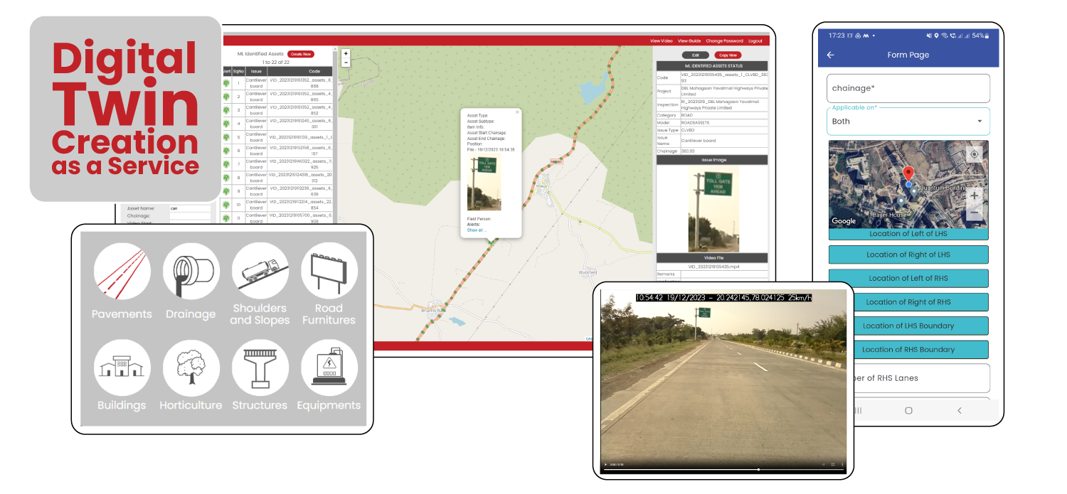
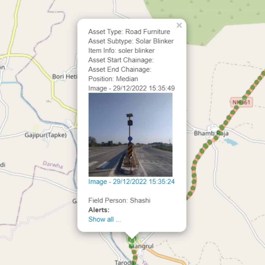
IBC Cube Roads also provides a Road Information Management System that enables users to manage location, chainage, sector, and asset information for multiple road projects. With this system, users can easily access detailed information about each project's salient features and road chainage mapping, all in one place. The platform also allows for the marking of different types of assets, major intersections, junctions, slip roads, and service roads. The exact GIS mapping, position mapping, and LHS/RHS/median mapping of assets with images make it easy to identify and track each asset's location. Users can generate asset status, asset summary, and asset listing reports, providing a comprehensive overview of all road assets. The system's chainage feature provides an easy-to-use method for tracking and managing the location of road assets along the road's length.
- Upload of existing project, chainage and asset information
- Mobile-based physical chainage capture with location and images across various points on LHS, RHS and Median at each chainage marker
- Mobile-based physical asset capture with location and images
- Vehicle Camera-based Asset Capture using AI/ML for object detection with detailed video footage of the road by location on a map
- Detailed Salient Features and Road Chainage Mapping of All the Projects at one Place
- Marking of Different Types of Assets, Major Intersections, Junctions, Slip and Service Roads
- Exact GIS Mapping, Position Mapping, LHS/RHS/Median Mapping of Assets with Image
- Asset Status, Asset Summary and Asset Listing Report
Modules
in this
Application

Road Chainage

Projects

Pavements

Drainage
Shoulders and Slopes

Road Furniture

Buildings

Horticulture

Stucutures
Equipment